

Queen Elizabeth Park
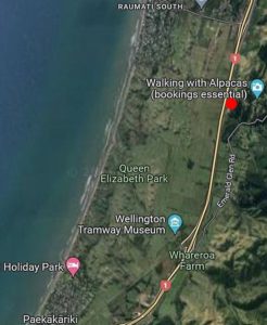 Queen Elizabeth park is located between Paekakariki in the South, Raumati South in the North, and the SH1/59 highways in the East. Its total size is approximately 638 hectares and it is one of the most popular recreational areas in the greater Wellington region.
Key access to thepark is via Mackays Crossing entrance off SH1, via Paekakariki and through Raumati South.
The park allows for a variety of recreational activites, including swimming of the beach, walking/hiking, horse riding, and cycling/mountain biking. The park offers a variety of hiking tracks, mostly shared with bikes and horses. Greater Wellington have published a trial map of the Queen Elizabeth Park.
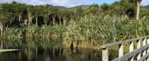
The park consists of wetlands, dunes, kahikatea forest remnants, paddocks, and a safe swimming beach.
Since late 2022, Greater Wellington is rebalancing equestrian recreation in Queen Elizabeth Park, ceasing most horse grazing in favour of expanding casual horse riding and trekking facilities while implementing its policy of restoring the natural environment of the park. Many volunteering groups are currently active in the park to achieve these goals.
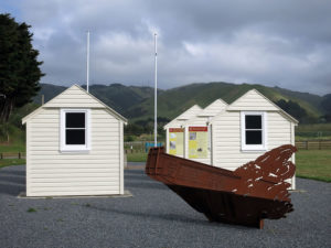 Between 1942 and 1944 over 15,000 American troops were stationed at Queen Elizabeth Park (then Camp Russell), Whareroa Farm (then Camp Mackay) and Paekākāriki Village (then Camp Paekākāriki). When World War II broke out in 1939, New Zealand gave total support to Britain and sent our army to the Mediterranean. By 1942, Singapore had fallen and the South Pacific was under threat by Japan. New Zealand agreed to leave its army in North Africa, and so the United States Marines were sent to New Zealand to prepare for the possibility of a Pacific War and protect the country from an invasion.